
Google Maps has recently introduced a wonderful new service: “mash-ups.” The idea harkens back to push pins (think old fashioned detective movies where they put in pins for crime sites to discern the pattern). In this case, the “push pins” are virtual, blue ones and the map base is Google Maps. Instead of colored pins, you click on the pin and a dialogue box appears.
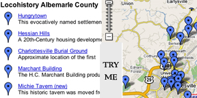
I have recently added this feature to the locohistory blog. For most entries I will post an accompanying “pin” on the map. For those reading the blog, it will be a good way to orient yourself as to the location of historic features in Albemarle County. For new readers who want an overview of locohistory, you can begin with the map page and click through some pins (each of which will contain a url for the accompanying blog post). To view the map, click here. To locate a site on any given post, click on “Map It!.” I welcome feedback on this new feature (or suggestions for improvement). Explore it!